Tashkent, May 2026 – For the first time in its post-independence history, Uzbekistan has successfully mapped and digitized the complete boundaries of its forest territories, marking a historic milestone in environmental governance and climate action. This groundbreaking accomplishment, achieved through the RESILAND Project with generous support from the World Bank, establishes the essential foundation for transforming how the nation manages its most vital natural resources.
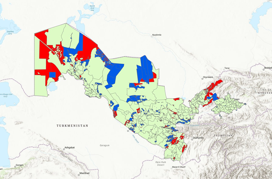
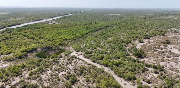
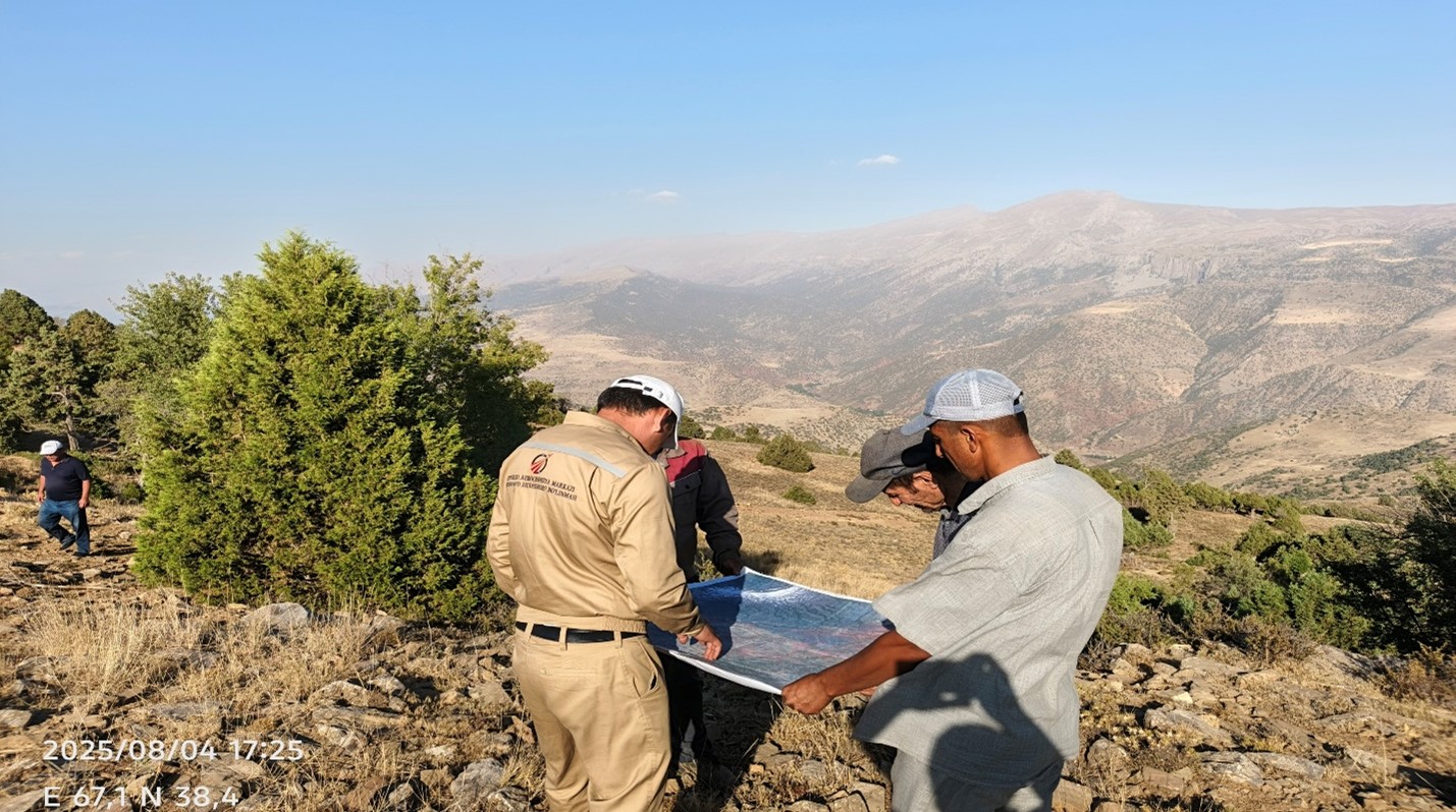
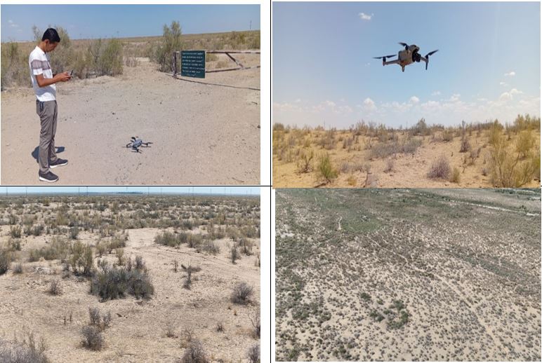
Working across more than 7 million hectares of land, the State Forest Agency, the Cadastre Agency, and the Republic of Aerogeodesy Center have deployed cutting-edge satellite and aerial imaging technology to precisely document the location, extent, and characteristics of Uzbekistan's forests. What was once an insurmountable challenge—defining the exact boundaries of 79 state forest enterprises scattered across the country—has now become a digital reality.
|
"This is work of historic significance," said Erkin Mukhtdinov, Director of the State Forest Agency.
"In the 60-70 years of our agency's history, we have never undertaken a task of this magnitude. These precise boundary data will transform how we account for our forests and assess the true health of our forest cover. We are grateful for the World Bank's partnership in making this vision a reality," noted said Erkin Mukhtdinov
|
World Bank Partnership Unlocks Innovation
The RESILAND Uz Project represents a strategic investment in Uzbekistan's environmental future, supported by the World Bank's commitment to climate resilience and sustainable development in Central Asia. Under the technical leadership and supervision of Asferachew Abate Abebe, Senior Environmental Specialist and Task Team Leader (TTL) for World Bank Projects in Central Asia, the project has seamlessly integrated international best practices with Uzbekistan's domestic priorities, creating a model for arid-region forest management.
Mr.Asferachew brings extensive expertise in implementing major environmental sustainability and climate resilience programs across the Central Asia region. His leadership has been instrumental in ensuring that the RESILAND Project achieves the highest international standards while remaining responsive to Uzbekistan's unique context and needs.
The World Bank's technical and financial support has enabled Uzbekistan to access world-class remote sensing technology and coordinate with international forestry expertise that would otherwise be beyond reach. This partnership approach has accelerated the timeline for achievement while strengthening the institutional capacity of Uzbekistan's forest management agencies.
Breaking Through Data Barriers
|
By the Numbers
|
The findings have already revealed critical insights that were previously impossible to document. Researchers discovered that actual forest coverage exceeds earlier records by more than 513,000 hectares—evidence of forest growth and successful restoration efforts that had gone unrecorded. Conversely, some previously documented forest areas proved smaller than expected, pointing to the need for urgent intervention in certain zones.
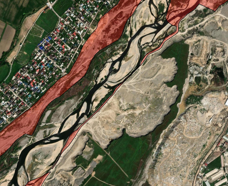
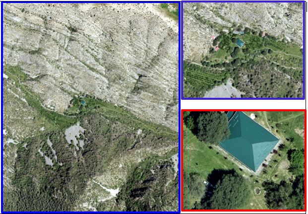
These discoveries are only possible because of an innovative technological approach. The project deployed the Tescan P2006T aircraft, equipped with a Leica DMC III high-resolution camera, to conduct digital remote sensing across the entire forest fund landscape. The resulting orthophotoplans—spatially precise digital images—have been processed into an electronic format accessible to forest administrators and integrated into the nation's SMART FORESTRY platform.
"We captured over 7 million hectares of forest territory in digital images and processed them to 100% completion," explained G'aniyev Abdusalim, Deputy Director of the Republic of Aerogeodesy Center.
"These orthophotoplans are now available to the State Forest Agency in a format that enables precise field work, cadastral verification, and boundary clarification for every forest contour. This achievement represents a significant leap forward in our technical capacity," he said.
From Data to Global Climate Action
The significance of this achievement extends far beyond Uzbekistan's borders. The RESILAND Project directly supports the nation's commitments to the United Nations Sustainable Development Goals, particularly SDG 13 (Climate Action) and SDG 15 (Life on Land), by providing the accurate baseline data necessary for climate reporting and environmental monitoring.
Perhaps most critically, the RESILAND Project enables Uzbekistan to fulfill its pledges under the LDN and Bonn Challenge—a global initiative to restore 350 million hectares of degraded forest by 2030. Without precise baseline data, countries cannot reliably identify restoration priorities, measure progress, or report results to the international community. Now, Uzbekistan possesses that capability.
"Accurate forest mapping is the foundation of climate resilience in arid regions like Central Asia," explains the project's technical framework.
"It allows us to document how well our afforestation efforts are working, understand our vulnerability to desertification, and quantify carbon storage for climate mitigation. The World Bank recognized this as a critical investment in Uzbekistan's climate adaptation strategy."
Strengthening International Climate Partnerships
The World Bank's support for the RESILAND Project signals confidence in Uzbekistan's commitment to climate action and positions the country as a leader in developing innovative approaches to environmental challenges in arid regions. By demonstrating that comprehensive forest mapping is achievable even in complex, resource-constrained environments, Uzbekistan opens doors to additional international climate finance and technical cooperation.
Unlocking Economic Potential
Beyond environmental benefits, complete forest mapping opens economic doors that were previously closed. Sustainable timber certification, payment for ecosystem services, carbon credit schemes, and green financing mechanisms all depend on transparent, documented forest data.
Communities and foresters can now benefit from accurately documented land rights and forest benefits, supported by legal frameworks grounded in precise spatial data.
The integration of forest boundaries into Uzbekistan's National Cadastral System means that for the first time, property disputes related to forests can be resolved with scientific precision, and government agencies can coordinate land-use decisions without ambiguity. The World Bank has emphasized the importance of this transparency in unlocking investment and building trust among stakeholders.
A New Era of Transparency and Accountability
What makes this moment genuinely historic is not just the technology or the scale, but what it represents: a commitment to transparency in natural resource management. Instead of relying on estimates or historical records, Uzbekistan's forest administrators now have a shared, verifiable picture of what exists where.
"This work enables real-time monitoring and adaptive management across all 79 forest enterprises," said officials involved in the RESILAND Project staff. "For the first time, we can make decisions based on evidence rather than approximation. This is transformational, and it reflects the kind of evidence-based governance."
The data also reveals what hasn't been working. The discrepancies between recorded and actual forest coverage highlight areas where restoration efforts have succeeded beyond expectation—and where urgent intervention is needed. Armed with this information, policymakers can allocate resources more effectively and track whether investments in reforestation are delivering results.
Building on Success: The Road Ahead
The successful completion of this major mapping initiative sets the stage for the next phases of the RESILAND Project, which will build on this foundation to implement restoration activities, establish continuous monitoring systems, and develop climate-smart forestry practices tailored to Uzbekistan's arid environment.
The Forestry Agency has committed to continued partnership through these subsequent phases, ensuring that the data infrastructure created through this initial investment becomes the backbone of sustainable forest management in Uzbekistan.
|
"The hard part—establishing the baseline—is complete, now comes the equally important work of using this data to drive real improvements in forest health and community livelihoods." |
A Model for Arid-Region Development
As climate change intensifies pressures on water availability and soil stability across Central Asia, the ability to map, monitor, and manage forests with precision becomes increasingly critical.
|
"We are confident that through this work, we will achieve accurate assessment of forest land conditions and faithfully fulfill our obligations to the international community," said Erkin Mukhtdinov, Director of the State Forest Agency. "The partnership with the World Bank, guided by professionals like Asferachew who understand both international standards and regional contexts, has been essential to our success. We look forward to deepening this collaboration in the years ahead." |
Uzbekistan's achievement with the RESILAND Project offers a model that other countries in arid regions can follow—demonstrating that even in challenging environments with limited resources, modern remote sensing technology makes comprehensive forest mapping achievable.
The Uzbekistan Resilient Landscape Restoration Project (RESILAND Uzbekistan) is part of the World Bank’s RESILAND CA+ program, aimed at strengthening landscape resilience across Central Asian countries. Similar national and regional activities are also being implemented in Kyrgyzstan and Tajikistan.
RESILAND Uzbekistan is implemented by the Agency for Afforestation, Expansion of Green Areas, and Combating Desertification under the Ministry of Ecology, Environmental Protection, and Climate Change of the Republic of Uzbekistan, with financial support from the World Bank, PROGREEN, and KWPF.
The Regional Environmental Centre for Central Asia (CAREC) implements the regional component of the Uzbekistan Resilient Landscape Restoration Project.
Photos