By Solijon MIRZOEV,
Project Coordinator, Tajikistan Resilient Landscape Restoration Project,
Committee for Environmental Protection under the Government of the Republic of Tajikistan (CEP RT)

Forest ecosystems in Tajikistan are under significant and growing pressure. Although forests occupy only a small proportion of the country’s territory, their role in maintaining ecological balance is difficult to overestimate: they provide protection against erosion, regulate water resources, act as a barrier against dust storms, and support unique mountain biodiversity.
However, over recent decades these ecosystems have faced a complex set of serious challenges. Excessive livestock grazing hinders natural forest regeneration, local logging—both legal and illegal—exerts additional pressure; and climate change leads to increased aridity, a higher risk of fires, and more frequent dust storms.
The saxaul forests in desert zones, pistachio open woodlands in the south, and juniper forests in northern regions are particularly vulnerable and are experiencing the most intensive degradation.
Against this backdrop, systematic data on forest conditions have been limited and did not reflect the real situation on the ground. The last large-scale forest inventory conducted during the Soviet period covered only selected forest enterprises and was carried out by specialized organizations such as “UzLesproekt” and the Almaty Forest Inventory Unit.
Although these efforts enabled management planning at individual forest enterprises, they did not provide a unified national-level picture. After the collapse of the USSR, regular forest inventory activities ceased, and for several decades the country effectively lacked a modern forest monitoring and management planning system.
Even the definition of the term “forest” in national legislation was updated only in 2011, which required a revision and clarification of all previously existing statistics that had been compiled based on the old (All-Union) definition of forests and only for lands of the State Forest Fund.
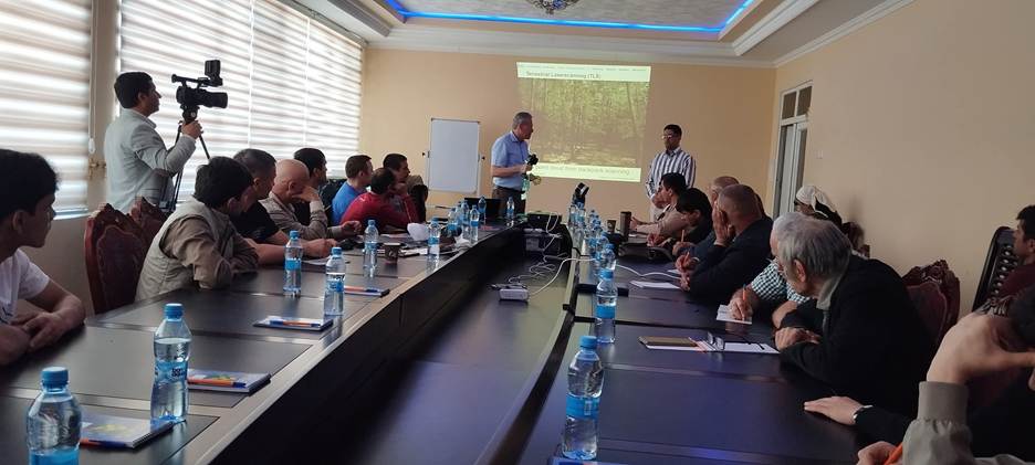
It was precisely under conditions of an information vacuum and growing environmental threats that the need arose for the first national forest inventory in the history of Tajikistan. This project is being implemented within the framework of the World Bank program “Tajikistan Resilient Landscape Restoration Project” and is carried out by a consortium consisting of the State Unitary Enterprise “Aerogeodesy Dushanbe” and the Austrian company Umweltdaten GmbH.
“Aerogeodesy Dushanbe” is responsible for fieldwork, data processing, and mapping, while the international partner ensures the introduction of modern methodological approaches, artificial intelligence algorithms, and the standardization of procedures.
The current inventory is based on advanced technologies that have not previously been applied at the national level in Tajikistan.
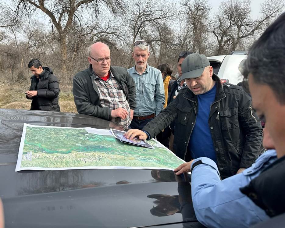
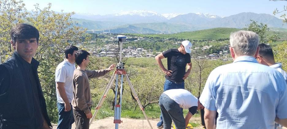
Sentinel-2 and RapidEye satellite data form the basis for mapping forested areas. All geospatial data are analyzed using GIS software such as ArcGIS and QGIS, applying machine learning methods to achieve higher accuracy and enable automated classification of forest formations.
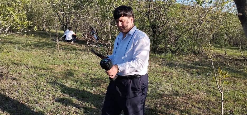
Field surveys employ not only classical forest mensuration practices—measuring diameters, heights, and stand density using traditional instruments—but also mobile LiDAR laser systems. Laser scanning creates three-dimensional forest models, revealing the structure of tree stands with exceptional detail and precision.
The combination of satellite analysis, GIS tools, artificial intelligence, and LiDAR opens a qualitatively new level of understanding of Tajikistan’s forest resources.
According to preliminary results, perceptions of the extent of forest-covered areas have already been revised: modern methods indicate that forest cover accounts for approximately 4.7 % of the country’s territory. However, the main value of the project lies not in the figures themselves, but in the creation of a foundation for systematic monitoring that can be conducted every ten years in the future.
The results of the national forest inventory will provide the country with what has been lacking for many years: a unified statistical framework and reliable data on forest conditions, degradation and recovery processes, regional differences, and key threats.
These data will serve as the basis for developing new state programs, climate change adaptation strategies, fulfilling international obligations under the UNFCCC and the Paris Agreement, and planning reforestation activities. Moreover, they will support the development of measures to combat dust storms—one of the most acute environmental problems observed in the country in recent years.

Thus, the national forest inventory is becoming not merely a technical procedure, but a strategic development tool. It helps overcome a long-standing information deficit, establishes a scientifically grounded foundation for environmental policy, and creates a real opportunity to preserve Tajikistan’s forest ecosystems for future generations.
Additional information:
Project Coordinator, Tajikistan Resilient Landscape Restoration Project Committee for Environmental Protection under the Government of the Republic of Tajikistan (CEP RT)